

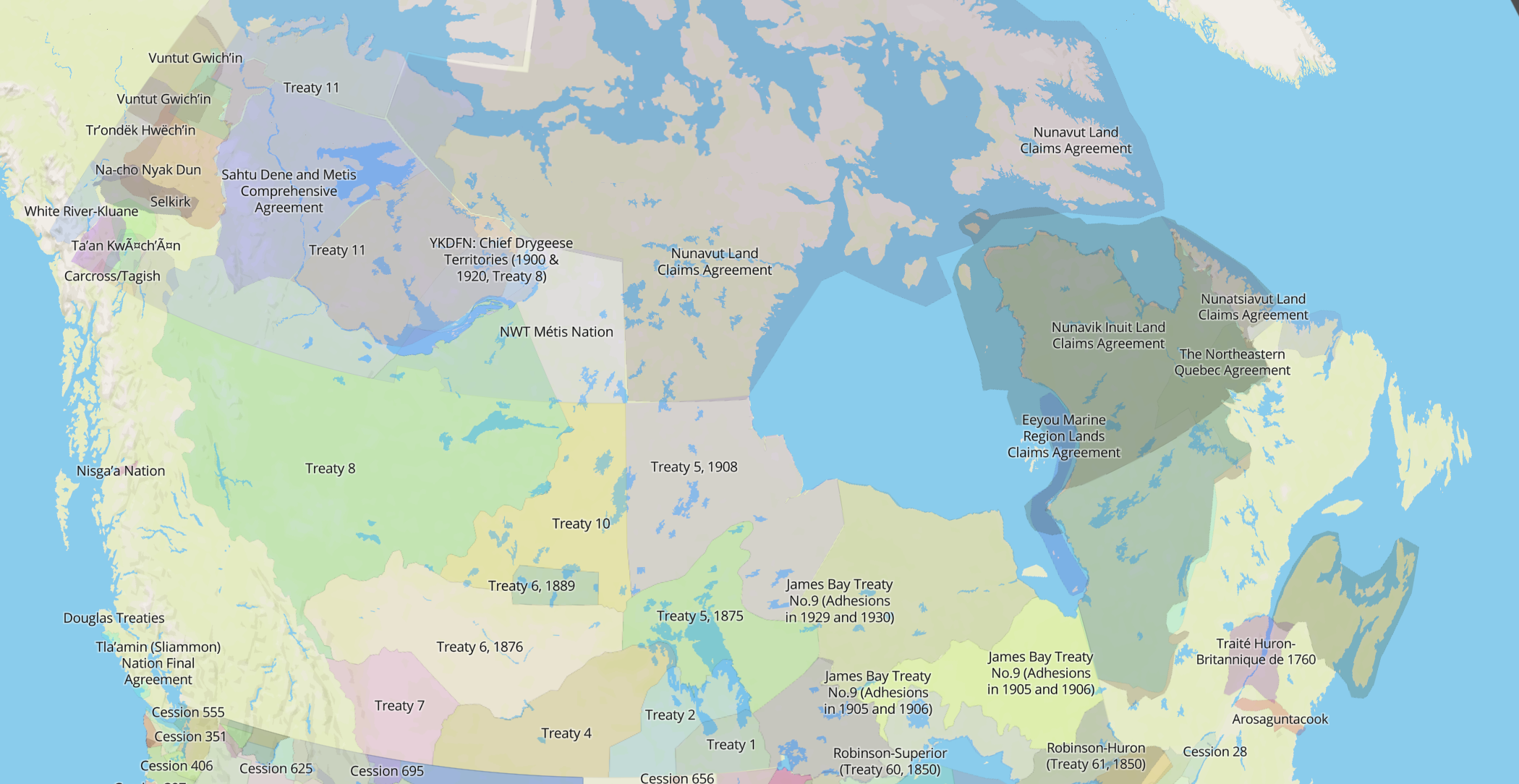
The most popular layer on the Native Land map — and the one I have turned on by default — is the “territories” layer. This is a bit of a paradox, because it’s both the most intuitively understandable layer and the most complicated to explain.
The territories layer began as something quite straightforward: mapping something called ‘traditional territory’. The notion of traditional territory, for me, as a settler, was mostly informed by the practice of “territory acknowledgement” and the vague idea that all this land in Canada was previously ‘owned’ by someone else.
Native Land relies on the idea of “traditional territory”, and without this theoretical underpinning, the map itself wouldn’t make sense. But this idea is flawed and does rely to some degree on colonial structures of land boundaries, certain types of sources, and ignores migration and the complexities of real-life Indigenous societies.
 I’ve learned that the idea of ‘traditional territory’ is actually very slippery. It can mean a strongly defined official boundary (Squamish nation, for instance), a general sense of land familiarity or habitation (some Métis people), a historically inhabited area, or it can be shorthand for how people identify themselves. The map tries to encompass all of these meanings, by taking feedback and changes seriously. But the map is also trying to say something specific about land ownership and colonization, and that’s what it’s really about.
In fact, I’d say that the idea of traditional territory should be slippery, because it’s about land and culture, and these things can’t be defined by simple categories. Otherwise, it becomes too colonial again and forces identities onto Indigenous people, who, like all peoples, have diverse ways of understanding the self.
Some nations have official boundaries of traditional territory, whereas other nations may hardly even have a notion of being a “nation” at all. Recently adding many Central and South American territories to the map helped illustrate this for me.
When it comes to these areas of the map, “languages” may make more sense than “territories” to be a primary layer. In places where Indigenous national identity is not so strong as in Canada, languages can be more generally applied to ethnicities and societies without requiring a formal organization. Not all Indigenous people have similar tribal/national structures that I’ve encountered in some parts of North America, and this needs to be reflected in the map.
 Above all, I’ve tried to make the territory layer about self-identification. Whenever people feel they or their peoples are not represented, I’ve attempted to add them (with some interesting caveats I’ll write about another time). I prefer to try to be inclusive and show more results rather than less.
I would love to hear suggestions and hear about what ‘traditional territory’ means to people, what it means when it’s on the map, and its limitations and strengths.
So approach the layer with caution, and don’t treat it as an academic set of truths — if you can help it. It’s a good place to get started, but it’s really about you taking the initiative to learn more and think carefully about these questions.
I am from Arcata in Humboldt County, California. I have heard a story that supports a fluid nature of group boundaries that I will share. Precontact there was apparently a single family from the Hoopa Valley (Hupa people) that had food collecting rights to just one of the many rocky islets in the ocean near present day Trinidad, California. Precontact there was a village of Yurok people in that area. Hoopa valley is a couple dozen miles inland and the people living there otherwise didn’t have direct access to the resources of the ocean. My informant was a colleague in biology who had befriended people who knew of this traditional access right.
I grew up in western New York State, USA, just west of the Finger Lakes, on the lands of the Seneca, keepers of the western door of the Iroqouis Five Nations. I would be interested to know why Seneca is on the language map but not on the territory map? There seems to be a big gap in the map there. This map and website are absolutely fascinating by the way. This research is very important, great work!
Hi Tom, thanks for the comment and for reminding us of this. We have been meaning for quite a long time to remove the Confederacy and just include the individual nations, including the Seneca. We actually have just added the territory in the backend but it hasn’t yet been pushed up to the frontend. It should be added in the next week or so, so please check back again soon. Thanks so much!
Readers may find this interesting also…I grew up in Castile, NY, *literally on* the first reservation lands the Seneca were forced off of when the settlers and land speculators wanted it. The roads above and below my house (where my parents still live) were Upper, Middle, and Lower Reservation Roads. The native people were forced onto a second reservation, the Cattaraugus Reservation, a small plot of land near Buffalo, NY. At some point after? that they were also placed on the Allegheny Res near the border with PA. That’s the history as I understand it; I bet others know it much better and more intimately. The land I grew up on looks down into the Genesee River valley and gorge. It is simply a beautiful spot, and I was always conscious growing up that it was not rightfully ours to take.
I live in northern Vermont now, lands of the Abenaki. I just met the Chief of the Nulhegan Band of Abenaki the other day. A great man.