

This is part of a series of posts illustrating how updates are made to the site together with some really great help from users.
User:
I just came across this site – what a great resource! However, I wanted to point out a couple of inaccuracies I found by just briefly searching places I know something about:
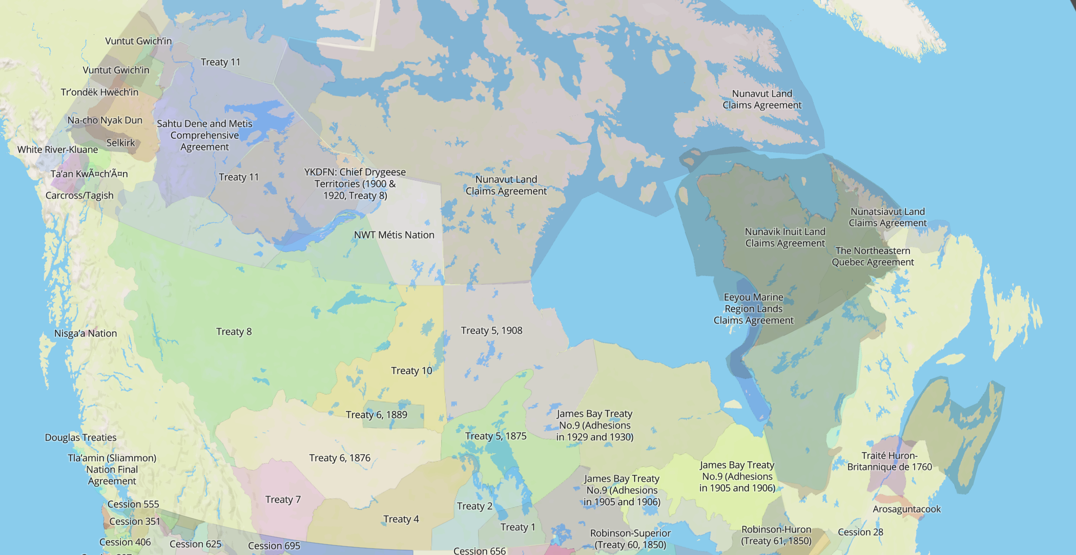
The language spoken in Watson Lake, YT, Lower Post, BC, and Good Hope Lake, BC is Kaska. The languages spoken in Ross River are: Kaska and Mountain Slave.
Native Land.ca:
Do you by any chance have access to any maps for this? I can adjust the boundaries manually anyway, but it can useful if there’s any maps I can trace and put as a source too. But if not, that’s OK!
Thank you again for messaging me about this and please feel free to spread the website around, it’s just starting to grow!
User
Thanks for the reply. Hmm, a map… I think putting boundaries around these kinds of things is always really tricky, because you are always going to have overlaps – nothing is really clear cut. However, as far as Kaska traditional territory goes, I would go by the Kaska Dena Council map: http://www.kaskadenacouncil.com/kaska-dena/our-land. Maybe the best way to go about it is to go by tribal maps, although again, there might be some overlaps and even some disputes about that too.
I was wondering, who are you and what got you into this project? I work on language revitalization with Kaska, that’s why I know more about it.
Native-Land.ca
I think overlaps are totally OK – I definitely don’t have a need to establish any kind of exclusive boundaries, since that’s not so much how things worked in the past or how they work today… reality is so fluid. I’m really trying to have this map just give general ideas, direction, some information to people who might want to know more.
It’s also meant to spark a kind of consciousness, especially amongst settler Canadians, that the land IS indigenous territory and it’s not just “terra nullius”, blank space, as so many settlers learn in our history and culture. I’m a settler myself, my family is largely from Spain and other parts of Europe, although I was born in traditional Katzie territory (Maple Ridge) and grew up in the Okanagan in BC. I do programming and web design for work – I have a little freelance operation – and I like to put my skills to work in things I care about.
I have been using a pretty wide variety of maps to try to come up with at least reasonable starting points for corrections, although I know it’s really not complete, and moreover these things are very controversial for good reasons. Reinscribing colonialism, boundaries, etc. Yet despite that it seems like this still might be something that’s better to have in existence than only silence. Does that make sense?
I’m the only one working on it so it’s pretty simple at this point, but I’m trying to get as much feedback as possible. Have talked with a wide variety of people, and they mostly seem into it, although there is plenty of criticism too. Like I said, I’m 100% ok with maps overlapping and taking criticism and suggestions, so feel free to send me any more resources or send it around to others who might have ideas.
By the way, I finally added the Kaska Dena according to the map you sent, and also doubled that for the language – we’ll see if I get more corrections/fixes on it. Let me know if you have any more too. Thanks!
User:
Great, thanks for the update! I think the website is a great idea! As I was driving up north to the Yukon back in June, I was actually thinking I wished there was a way to track the different traditional territories I was passing through! I am pretty familiar with Yukon and some parts of BC, but not all. I will take a look on the website when I have time, to see if I find any obvious mistakes about places I know about. I am still up north working. Perhaps a phone app is next!?! I think that would really be great!
Good morning everyone,
This is a wonderful opportunity for every State in the Nation to request One University in each State of the Nation, who has a representative number of Native/Indigenous Native Americans to look into that States history of the Population mix before the White Man came to take over the Nations of the Indigenous People and heard them onto waste-barren lands.
The History is fully available via the Tribal records, which will show how each tribal nation moved around and how they traded, interacted with each other before being corralled onto various reservations throughout the Nation.
This history must be maintained and honored as per Treaties signed as each of the 603+ tribes within North America are Sovereign by rights established by all human beings through out the World.
Allow outside folks who may know certain historical facts to post to a section of the sites for each State U for peer review.
Keep up the great effort and work.