
By Rudo Kemper, Interim Director of Technology
A common request that we get is how to make your own maps using Native Land Digital data.
It is possible to do so! The Native Land Digital dataset is made open and available to anyone per a Creative Commons 0 Public Domain license. We have an API for accessing all of the data, which is updated once daily.
This blog post walks through a couple of different options that are available to you to use the Native Land data in your own maps, from an easy one-click print/export option to using the Native Land Digital API data in mapping software such as Mapbox, QGIS, and ArcGIS.
1. Use the print button on the Native Land Digital front page map
If you don’t have any experience with GIS software, this is probably the best option for you.
On the Native Land Digital front page map, there is a print button on the bottom right.

Clicking this will export a screen-size PNG image of your current view of the map:

2. For Mapbox, use the Native Land Digital public tileset
Mapbox and Native Land Digital provide a public tileset for territories that is updated daily (whenever new areas have been added).

You can access the Mapbox Tileset ID, a breakdown of the properties, and a quick json recipe on Mapbox’s data exchange repository on github.
You can use this Native Land Digital tileset in any Mapbox maps, whether you are building your own maps using Mapbox GL JS, or using Mapbox Studio.
To add the tileset to a Mapbox Studio style, go to Add Layer -> Add source by ID, and paste in the tileset ID from the above Github repository.

This Mapbox story map by Digital Democracy uses the Native Land Digital tileset to show territory names on the map:

3. For QGIS, use the Native Land Digital geojson file generated by the API
On the Native Land Digital API page, you can download json files for the Territories, Languages, and Treaties data. These files are updated daily with any new additions that have been made.
If you click on the files in the browser, you may see something like this that could look unfamiliar if you haven’t worked with geojson data before:

But fret not, this file can easily be worked with in QGIS (and also converted to other geospatial formats you might be more familiar with, like shapefiles).
First, download the json file that you want to work with.
In QGIS, you can simply drop this json file onto your map canvas, or add the file via the menu by going to Layer -> Add Layer -> Add Vector Layer and selecting the file. That will prompt a popup to add the data as a polygon:

From here, the layer will be added, and you can use QGIS to further style the data, make selection of areas, or anything else.

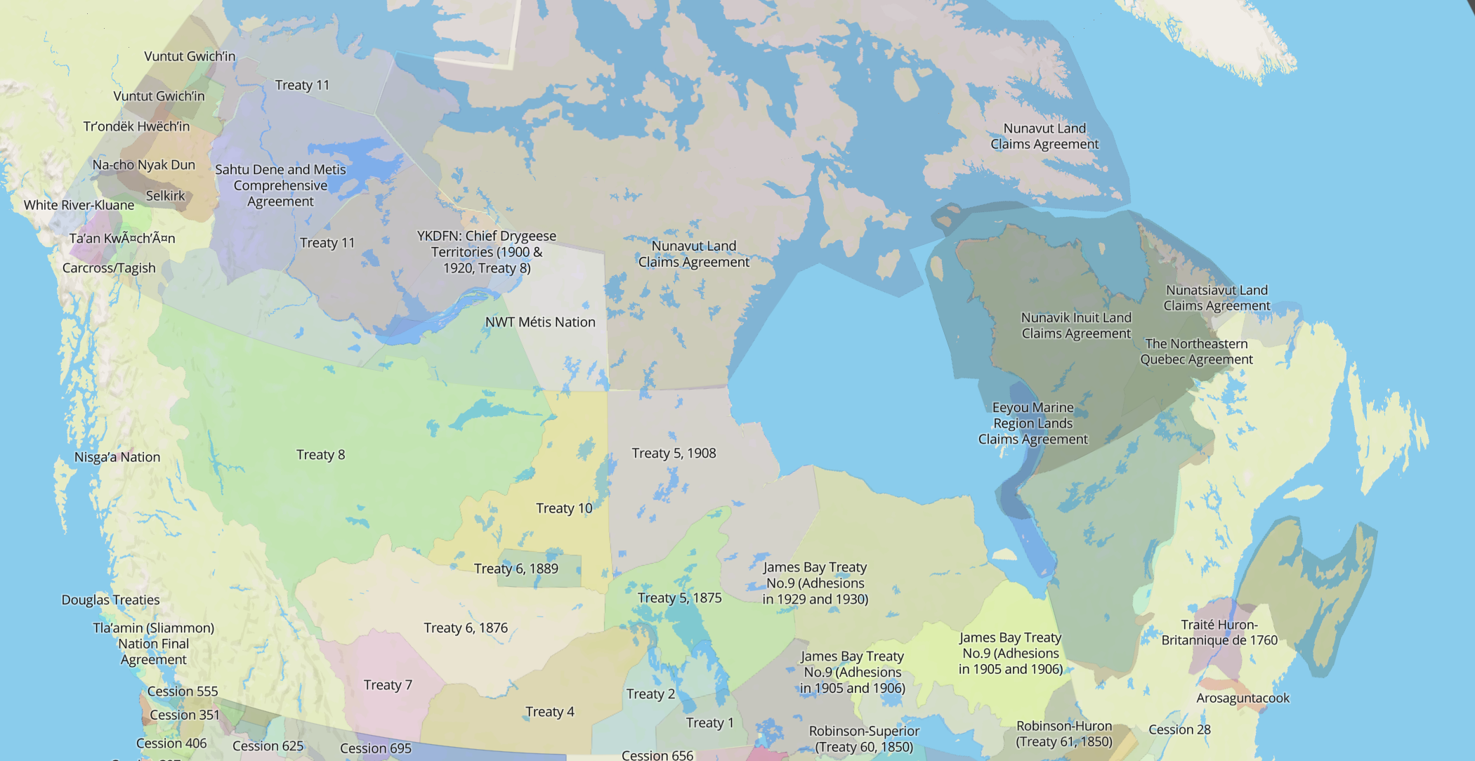
Here, I have created a quick layer with any territories that roughly intersect with the Caribbean, added a blue-greenish color ramp, and added labels:

4. For ArcGIS, use the Native Land Digital feature layer on ArcGIS Online Living Atlas
If you are an ArcGIS user, it used to be more challenging to incorporate Native Land Digital data into your maps. It is possible to download the geojson file as in the second method outlined above, and convert it into a shapefile using an online tool like mapshaper; however, this process can be a bit messy if you are not used to working with geojson files.
But we have good news – we have recently added a territories feature layer to ArcGIS Online that is set to update with the latest Native Land Digital data every Sunday! And as of February 22, 2023 this feature layer is now available in the ArcGIS Living Atlas!

You can open this feature layer in ArcGIS Online to make your own web maps, and you are free to style this layer however you want.

From the feature layer item page on ArcGIS, you can also download a pitemx or pitem file to use in ArcGIS Pro or ArcMap.
Here, I have opened the Native Land Digital territories feature layer in ArcGIS Pro and given the shapes a gray-ish hue:

As of February 2023, you can now simply add the Native Land Digital territories feature layer via the Living Atlas:

Have you made a beautiful or interesting map using the Native Land Digital API dataset? We would love to see it, and if you are open to it, feature it on our blog! Feel free to send us your maps at [email protected].