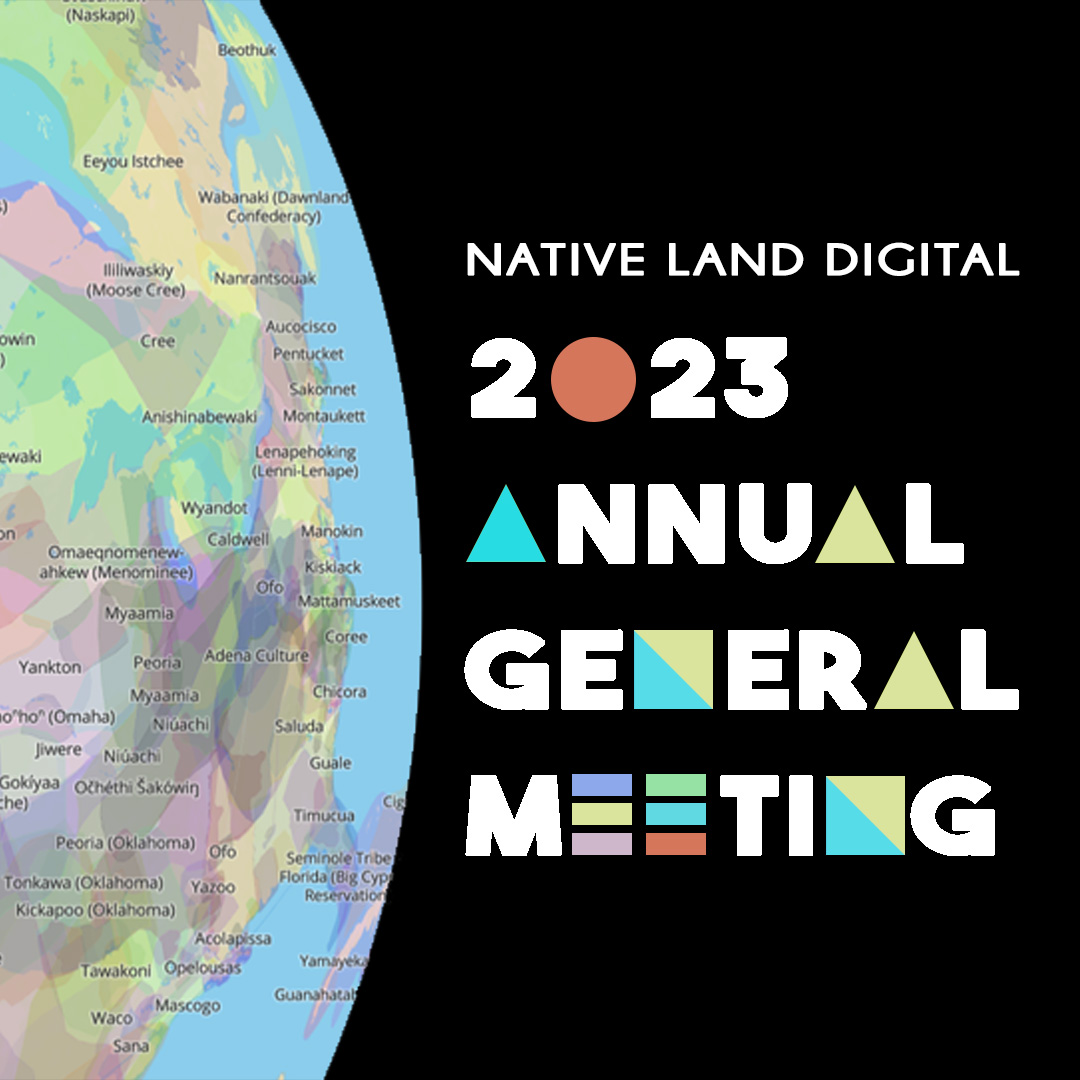
You’re Invited to NLD’s 2023 Annual General Meeting!
Hello everyone! You are invited to join Native Land Digital, a Canadian non-profit, for our annual AGM (Annual General Meeting) on Thursday, August 10, 2023 at 3:00 pm PST, 6:00 pm EST, and 10:00 AM NZST. This public meeting welcomes all who are interested in coming by to participate in the formal component of our […]
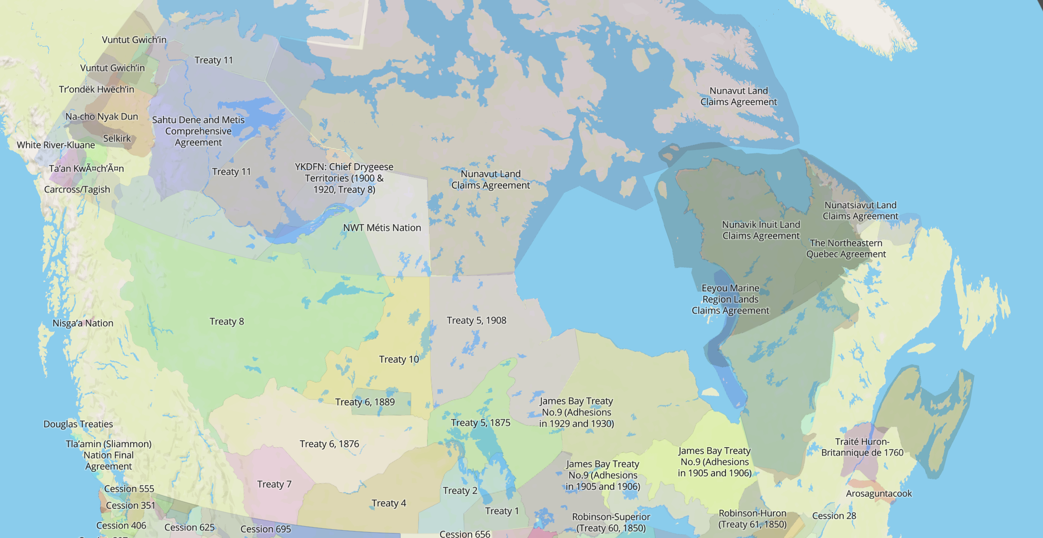
Guest Blog: Using the Native Land Map to Understand Our Treaties (The Gordon Foundation)
(This is a guest blog written by The Gordon Foundation.) Since 1975, 26 modern treaties have been signed in Canada. Treaties are a significant part of Canadian history, present and future, and learning about treaties is a key part of the Truth and Reconciliation Commission of Canada: Calls to Action. Modern Treaties also play an […]
How to add Native Land Digital data to your own maps
By Rudo Kemper, Interim Director of Technology A common request that we get is how to make your own maps using Native Land Digital data. It is possible to do so! The Native Land Digital dataset is made open and available to anyone per a Creative Commons 0 Public Domain license. We have an API […]
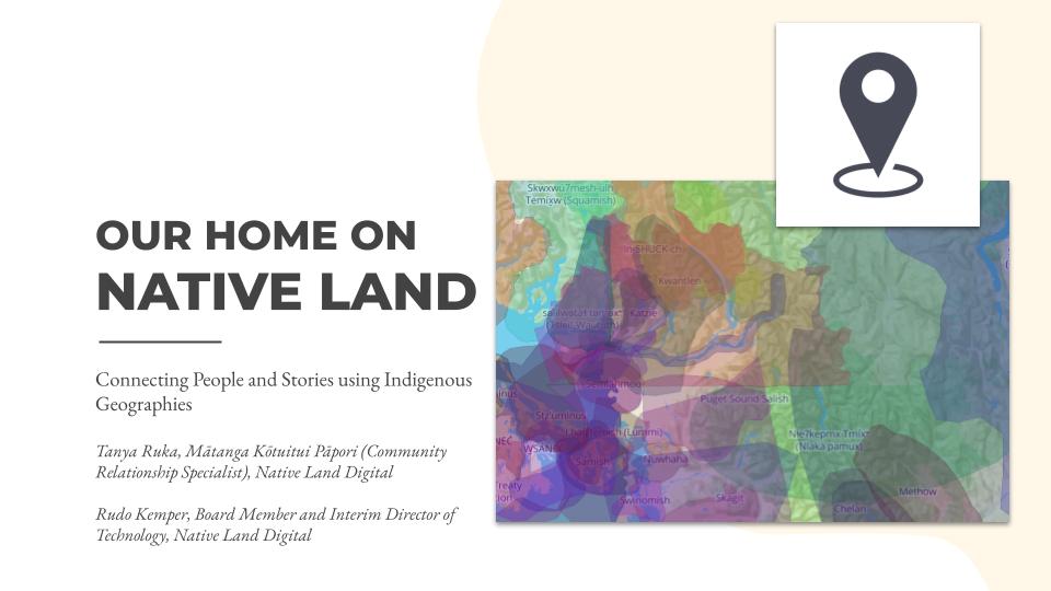
A video of our BTAA GIS 2022 Keynote presentation
A video of our keynote presentation at the BTAA GIS 2022 conference, titled “Our Home on Native Land: Connecting People and Stories using Indigenous Geographies.”

2022 Annual General Meeting
Hello everyone! Native Land Digital, a Canadian non-profit, is holding our annual AGM (Annual General Meeting) on Thursday, February 10, 2022 – and you’re invited to join us. This public meeting will run from 3:00pm – 6:00pm PST (6:00pm to 9:00pm EST) on February 10 2022. Beginning at 3:00pm we’ll be welcoming in whoever is […]
Guest Post: Hope Lab at the University of Calgary
Guest Post by Hope Lab and the University of Calgary
Cross-referencing Maps to Restore Missing Voices
A guest blog post submitted by the Pennsylvania Center for the Book at Penn State University Libraries featuring the Cultural Tour of Pennsylvania and Missing Voices lesson plans developed by Erica King, curriculum specialist, and the Center’s Literary & Cultural Heritage Maps of Pennsylvania. The Pennsylvania Center for the Book is a state affiliate of […]
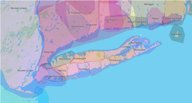
Using Native-Land.ca Data for Studying Indigenous Long Island, New York
By Kristen J. Nyitray and Dana Reijerkerk, September 22, 2021 A guest blog post written and submitted by Kristen J. Nyitray and Dana Reijerkerk about their research and recently published article titled “Searching for Paumanok: A Study of Library of Congress Authorities and Classifications for Indigenous Long Island, New York.” Abstract available at: https://doi.org/10.1080/01639374.2021.1929627. Kristen […]

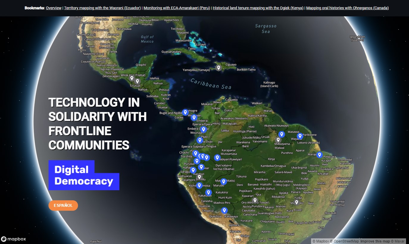
Our Wonderful, Wily API
Native Land Digital has provided an open, relatively easy API since the early days — ever since Canadian Encyclopedia asked us to develop an embed that they could use across their website. Since then, as the site’s data has grown, the API has also grown and it’s been used in many fantastic projects. A couple […]
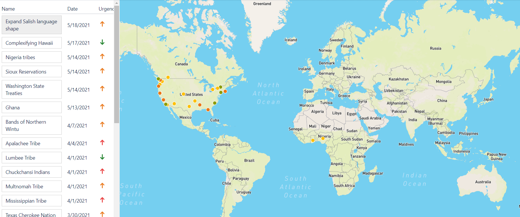
Organizing Research: The JIRA App
Here at Native Land Digital, we’ve put things together as they come. This organization and project didn’t start out with a grand vision and a comprehensive Business Plan — it started with an idea and putting in some work to get the thing moving. But, over the years, we’ve had to continually improve our processes […]
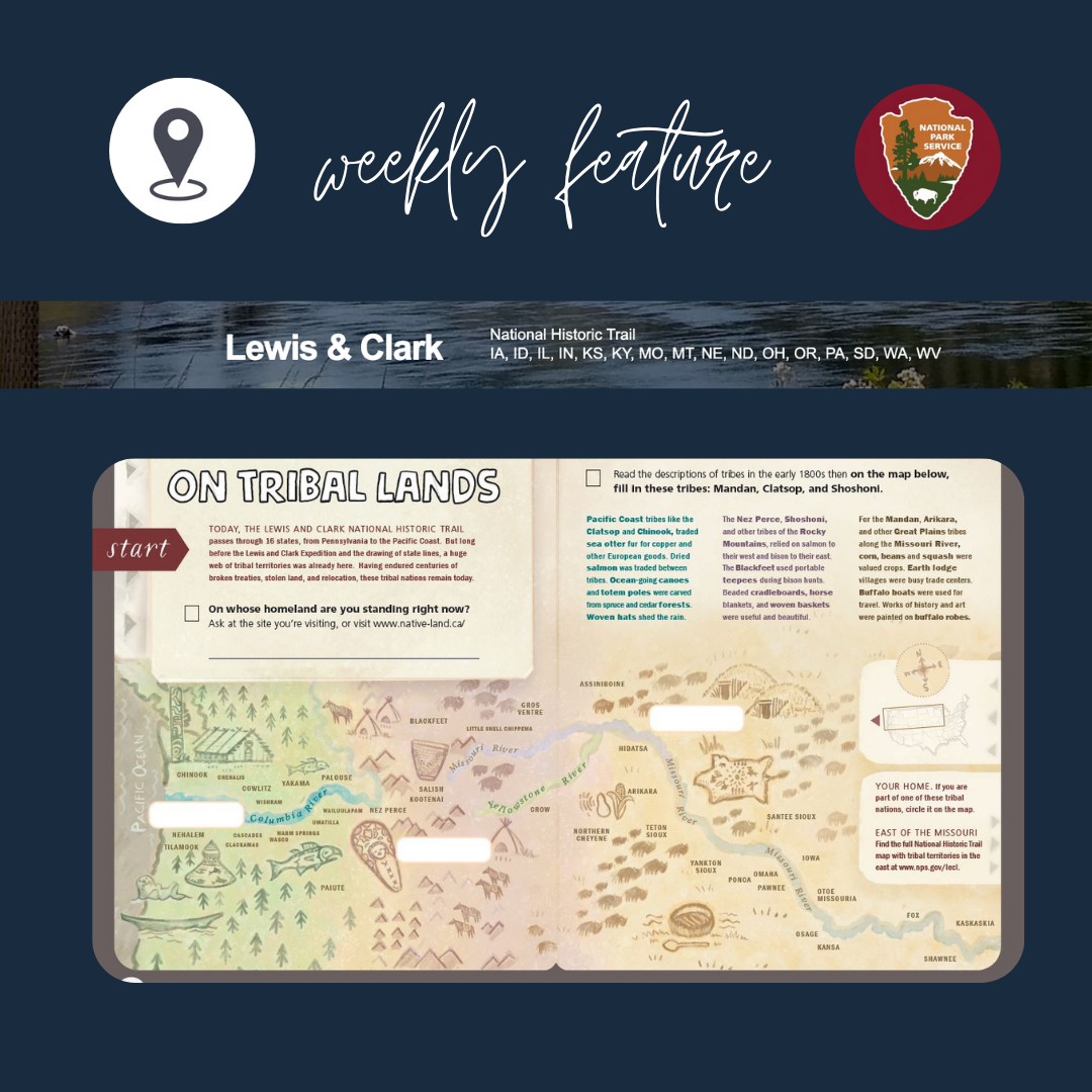
On Tribal Lands – Junior Ranger Activity Book
Guest blog post by Lewis and Clark National Historic Trail
Africa: Bit by Bit
We’re now getting underway with attempting to tackle mapping out different Indigenous groups in Africa. You can read a bit about the initial approach and how confusing everything is in the first post in this series, Approaching Africa. We’ve now had a few conversations with different people who specialize or are from different regions of […]
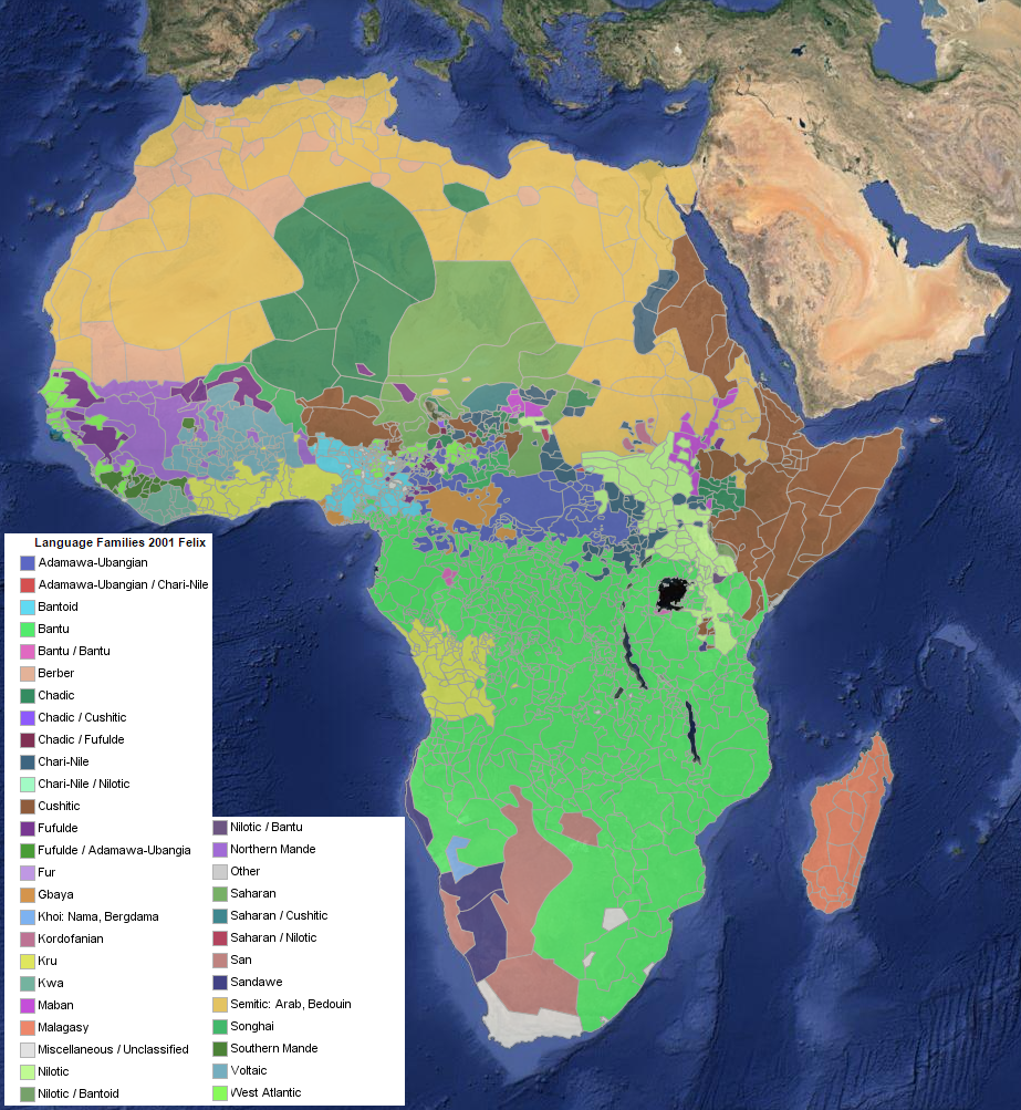
Approaching Africa
When it comes to the Native Land map, we’re always trying to balance two big goals: expanding the map versus improving the map where we already have shapes. We have been getting a lot of questions about why areas in Africa are not mapped out, and while this has long been on our goal list, […]
Becoming An Active Agent of Reconciliation
Hi there! My name is Lucas, and I’m a senior student at Gleneagle Secondary in Coquitlam, BC. I took some interest in traditional Indigenous knowledge and culture when I was younger, but it wasn’t really until my high school years when I started to delve more deeply into what it meant to be a Canadian. […]
The Land You Live On: Native Land Digital @ UBC
You are invited to join Native Land’s Executive Director, Christine McRae, for a virtual session with the University of British Columbia’s Centre for Teaching, Learning and Technology on Monday, May 11, 2020 at 12:00 pm EST, 9:00 am PST. This session will feature discussions of colonization, land rights, language, and Indigenous history tied to […]
Introducing Native Land’s Executive Director
Native Land Digital is very excited to introduce our new Executive Director, Christine McRae! Christine is an Omàmìwininì Madaoueskarini Anishinaabekwe (a woman of the Madawaska River Algonquin people) and belongs to the Crane Clan, and is of mixed Polish, Irish, German and Swedish heritage. Christine was raised in a small town on the eastern border […]
It Begins! The Birth of Native Land Digital
Hello everyone! Victor here. So, I know I have been awfully slow about it, but at last the Native Land organization has come together in such a way that we can get started for real. We received the formal incorporation documents just the other day, and we are officially now “Native Land Digital”. Lots of […]
Native Land roadmap update
Hello everyone! It’s been a few months, and a hot summer, since I posted the roadmap. We’ve made a lot of progress since then and a lot has happened. There’s still a very long way to go, but I’m definitely more confident and feeling like things are moving. Here’s a quick list of some things […]

Reflections on my job as Research Assistant for Native-Land
I am Victor Sauca, a Saraguro Kichwa from Ecuador currently working as the Research Assistant for Native Land from the ancestral, unceded lands of the Musqueam and Tsleil-Waututh people in what is now-called Vancouver, Canada. I acknowledge I came here to this beautiful land as an uninvited guest and without any idea of the presence […]
Native Land Roadmap
See the update to this post from late August 2018, detailing some of the progress we’ve made. Hey everyone. In the past month or so — stemming originally from a YesMagazine article — our popularity has shot up immensely. We’ve had over 100,000 visitors in the past week, and a lot of comments, fixes, thoughts, […]
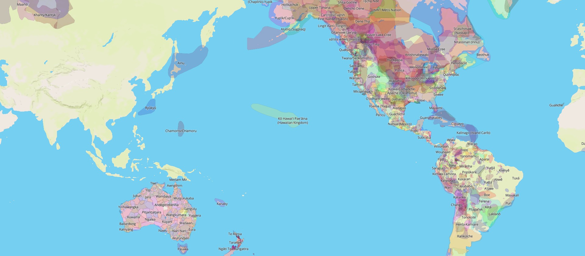
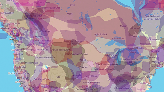
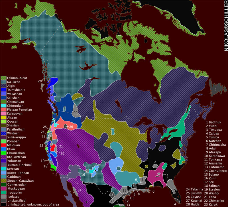
What is “territory”?
The most popular layer on the Native Land map — and the one I have turned on by default — is the “territories” layer. This is a bit of a paradox, because it’s both the most intuitively understandable layer and the most complicated to explain. The territories layer began as something quite straightforward: mapping something […]

Native Land, in transition
Hey! Victor here. Anyway, lately you might have noticed Native Land getting more active on social media. We have a new Communications Manager, Lydia Prince! I’ll introduce Lydia in another post, but first, people should know about what’s going on with Native Land. It’s all pretty exciting. It’s been like 3 (maybe 4?) years since […]

The Importance of Sourcing Properly
You know, when I started Native Land, I really meant to keep up with the sources. I wanted to be diligent about it and document everything properly. The best intentions! But along the way, things fall off. You get frantic about changes, or hear a correction in person, or forget after a long, long night […]
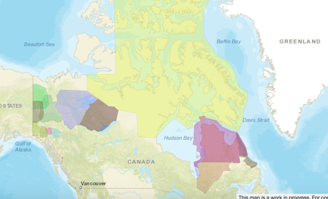
Land Area – Canada & Land Claims Agreements
Recently, I got an email from someone in Nunavut asking for some information about relative sizes of land agreements, compared to the overall land area of Canada. I’m not sure exactly what the information was being used for, but I thought it was interesting and I wanted to illustrate it here.
User Archive 2-2015
This is part of a series of posts illustrating how updates are made to the site together with some really great help from users.
A Question of Borders
One of the most distinctive things about the Native Land maps are the borders. They overlap crazily and make a huge mess of colours. Why’s that?

Building Native-Land.ca
Read a little bit about the work behind Native-Land.ca. (post originally written for Codementor.com)

What Year Does the Map Represent?
Does time really matter on maps? Of course it does. But how you map time depends on the purpose of your map.
The Blog.
Victor here. This is the start of the Native Land blog.